
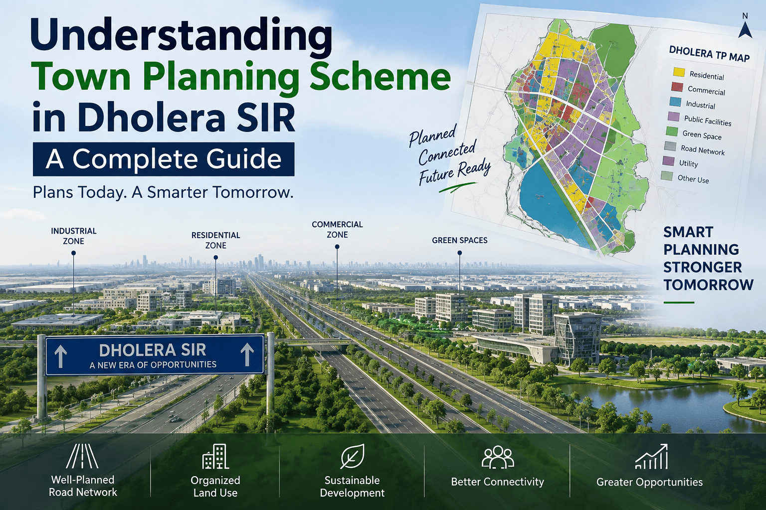
Dholera SIR is one of Gujarat’s major planned development regions, making it important for investors and property buyers to understand the Town Planning Scheme before evaluating land opportunities. A Town Planning Scheme provides a structured framework for roads, plots, infrastructure, public amenities, residential areas, commercial zones, and other planned development. Understanding the TP scheme, its maps, roads, and planning structure can help investors make more informed decisions when researching Dholera SIR.
What Is a Town Planning Scheme?
A Town Planning Scheme is a systematic planning mechanism used to organize land and infrastructure development within a defined area. Instead of allowing urban growth to happen without a coordinated structure, town planning establishes designated areas for roads, residential development, commercial activities, public facilities, open spaces, and other infrastructure.
A TP scheme helps create an organized relationship between land parcels and essential infrastructure. It considers factors such as road networks, public amenities, open spaces, development zones, and connectivity.
This approach becomes particularly important in large-scale planned developments such as Dholera SIR, where infrastructure and land use need to be coordinated over a large geographical area.
Importance of TP Scheme in Dholera SIR
The TP scheme is an important part of understanding the planned structure of different areas within Dholera SIR. Dholera is being developed with a focus on industrial growth, infrastructure, connectivity, and organized urban development.
For property investors, studying the planning framework provides useful context about how a particular location fits into the broader development plan.
Infrastructure and Land-Use Planning
Infrastructure planning includes roads, utilities, public facilities, open spaces, and different land-use zones. These components can influence accessibility and future development activity in an area.
It is important to distinguish between planned infrastructure and infrastructure that has already been completed or is operational. A feature appearing on a planning document does not necessarily mean that it is currently available on the ground.
TP Scheme Map and Its Importance
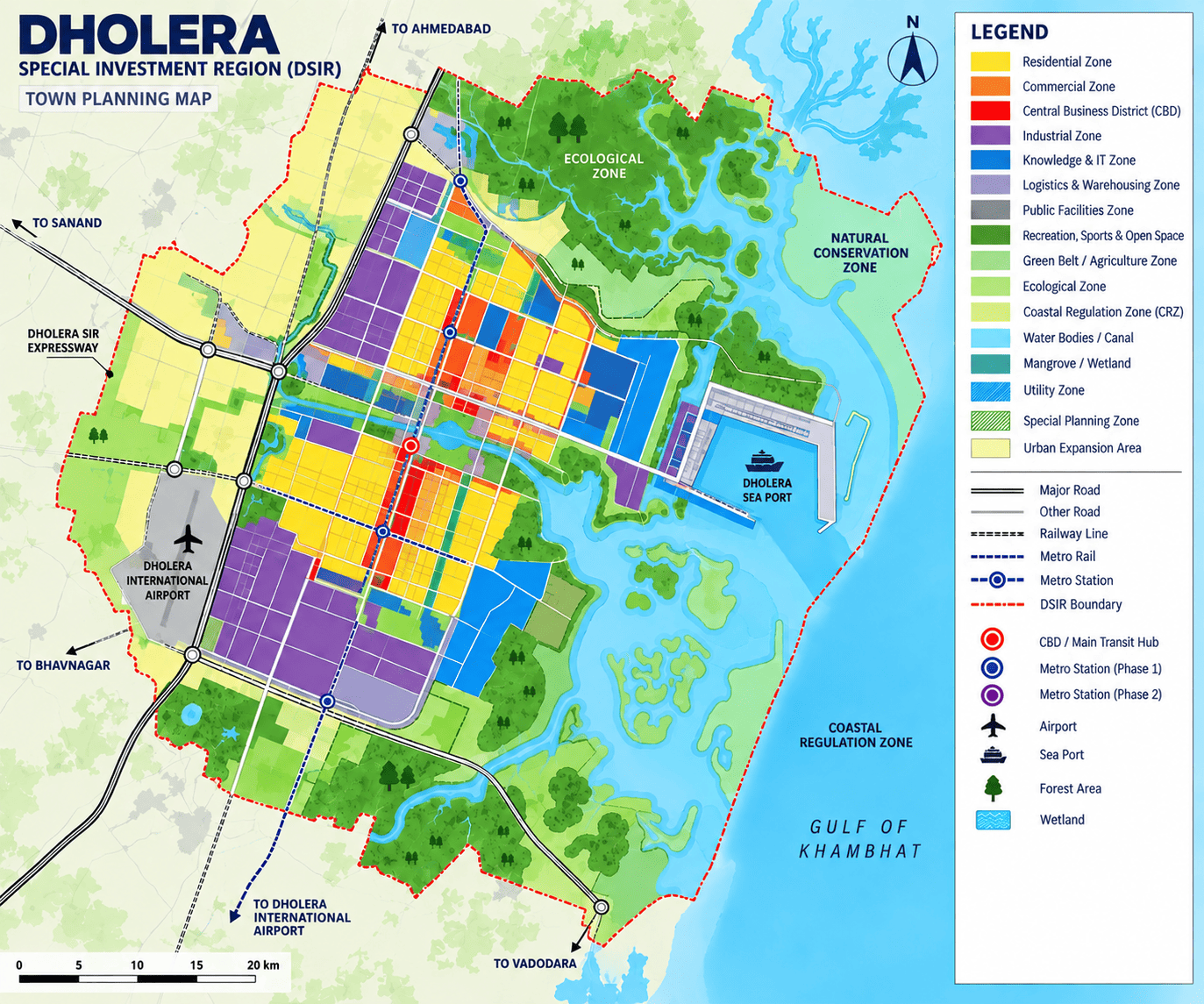
A TP scheme map is a visual representation of the planning framework for a particular area. Depending on the planning document, it may show land parcels, proposed roads, reservations, public facilities, zones, and other infrastructure components.
A town planning map can help investors understand the relationship between a property and its surrounding planned infrastructure.
Key Information Shown on Planning Maps
Depending on the specific document, a TP map may contain information related to:
- Road networks
- Land parcels
- Public amenities
- Open spaces
- Residential areas
- Commercial zones
- Industrial areas
- Infrastructure reservations
When reviewing a dholera tp map, investors should verify the source, date, and planning status of the document.
Town Planning Plans in Dholera
Town planning plans are developed to guide systematic growth within a particular area. In Dholera SIR, planning goes beyond individual properties and considers broader infrastructure, connectivity, land use, and urban development.
This makes dholera tp information useful when evaluating how a property relates to the surrounding development framework.
Existing and Proposed Development
An important distinction when studying planning documents is between existing and proposed development.
A road, facility, or infrastructure component shown on a planning map may still be at a planning or development stage. Therefore, investors should verify the current status of important infrastructure through reliable and authoritative sources.
Dholera TP Scheme
The Dholera TP scheme refers to the town planning framework applicable to designated areas within the Dholera development region.
Different planning areas can have different layouts, road networks, land-use provisions, and infrastructure requirements. Consequently, investors should examine the relevant planning documents for the exact location under consideration.
Dholera TP 1
Dholera TP 1 refers to a specific town planning area associated with Dholera. When researching TP 1 or another planning area, investors should refer to the latest available authoritative planning documents.
The applicable land use, road alignment, reservations, development status, and other planning details should be verified for the specific property rather than assumed from general marketing material.
TP Scheme Road and Connectivity
A TP scheme road forms part of the planned road network within a town planning area. Road planning is a key component of organized development because connectivity links residential, commercial, industrial, and public-use areas.
Role of Road Connectivity
Good connectivity can improve accessibility and support development activity around an area. However, investors should not assume that every road shown on a planning map is already constructed or operational.
Before purchasing a property, it is useful to verify the existing road access, proposed road alignment, road status, and relationship between the road network and the property.
Town Planning in Gujarat
Town planning in Gujarat follows a structured approach to managing urban development and infrastructure. Gujarat town planning involves coordinating land use, roads, public amenities, infrastructure, and development requirements.
The TP scheme Gujarat framework is relevant across several developing areas of the state and provides a structured approach to planned urban growth.
Relevance to Dholera SIR
Dholera's large-scale development makes organized planning particularly important. Understanding the broader TP scheme Gujarat framework can help investors become familiar with planning terminology and interpret relevant documents more effectively.
Reading a Dholera TP Map for Property Research
When studying a dholera tp map or tp map dholera, investors should look beyond the location of an individual plot and examine the broader planning context.
Road Connectivity
Review existing and proposed roads surrounding the property and understand their planned connectivity.
Land-Use Classification
Check whether surrounding areas are designated for residential, commercial, industrial, public, or other uses.
Infrastructure
Study the infrastructure planned around the property and distinguish between proposed and completed infrastructure.
Planning Status
Verify whether the information represents a proposed, sanctioned, or implemented planning stage.
Property Documentation
Land-use information should be considered alongside title, ownership, zoning, approvals, applicable RERA information, and other property documents.
These checks are particularly important when researching Dholera project details and evaluating a real estate opportunity.
Dholera TP Scheme and Real Estate Investment
The Dholera TP scheme can provide valuable context for real estate research because organized infrastructure and land-use planning are important components of urban development.
However, a TP scheme should not be considered a guarantee of property appreciation or investment returns.
Investors should evaluate multiple factors, including location, connectivity, infrastructure status, land-use classification, property documentation, approvals, developer credibility, and prevailing market conditions.
A planning map is therefore best viewed as one component of a broader property due-diligence process.
Frequently Asked Questions
What is a Town Planning Scheme?
A Town Planning Scheme is a structured framework used to organize land development, roads, infrastructure, public amenities, and different land-use areas within a defined region.
What is a TP scheme in Dholera?
A TP scheme in Dholera represents the planning framework applicable to a designated area, covering elements such as roads, land use, infrastructure, and public facilities.
What is a TP scheme map?
A TP scheme map is a visual representation of planning information such as land parcels, roads, reservations, zones, and infrastructure.
What is a TP scheme road?
A TP scheme road is a road planned within the town planning framework of a particular area. Its current construction and operational status should be independently verified.
What is Dholera TP 1?
Dholera TP 1 refers to a specific town planning area associated with Dholera. The relevant planning map, land use, road network, and development status should be checked for the particular property.
Does a TP scheme guarantee property appreciation?
No. A TP scheme represents planning and development provisions. It does not guarantee future property prices, appreciation, or investment returns.
Why is a Dholera TP map useful for investors?
A Dholera TP map can help investors understand the broader planning context, including roads, land use, infrastructure, public facilities, and surrounding development.